Precision Approach Terrain Chart (PATC )
What is PATC?
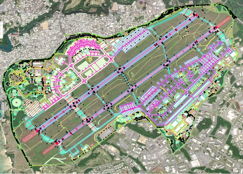
Procedure & Aerodrome Terrain Charts (PATC)
PATC provides clear, accurate, and standardized terrain and aerodrome charts that support safe flight procedures, situational awareness, and regulatory compliance across airport operations.
These charts translate complex terrain and obstacle data into easy-to-interpret visual formats used by pilots, planners, and aviation authorities for safer decision-making.
Why PATC Matters for Aviation Safety?
Turning Terrain Data into Operational Clarity
Flight safety depends on understanding what surrounds an aerodrome. PATC bridges the gap between raw terrain data and real-world aviation use by presenting critical information in a structured, visual format.
From approach planning to obstacle assessment, PATC charts reduce ambiguity, support compliance, and enhance operational confidence for aviation stakeholders.
What Our PATC Delivers
Terrain Representation
Clear depiction of surrounding terrain to support procedure design and safety assessments.
Obstacle Visualization
Accurate obstacle positioning and heights to improve awareness and reduce operational risk.
Standardized Layouts
Charts designed in line with aviation conventions for ease of interpretation and consistency.