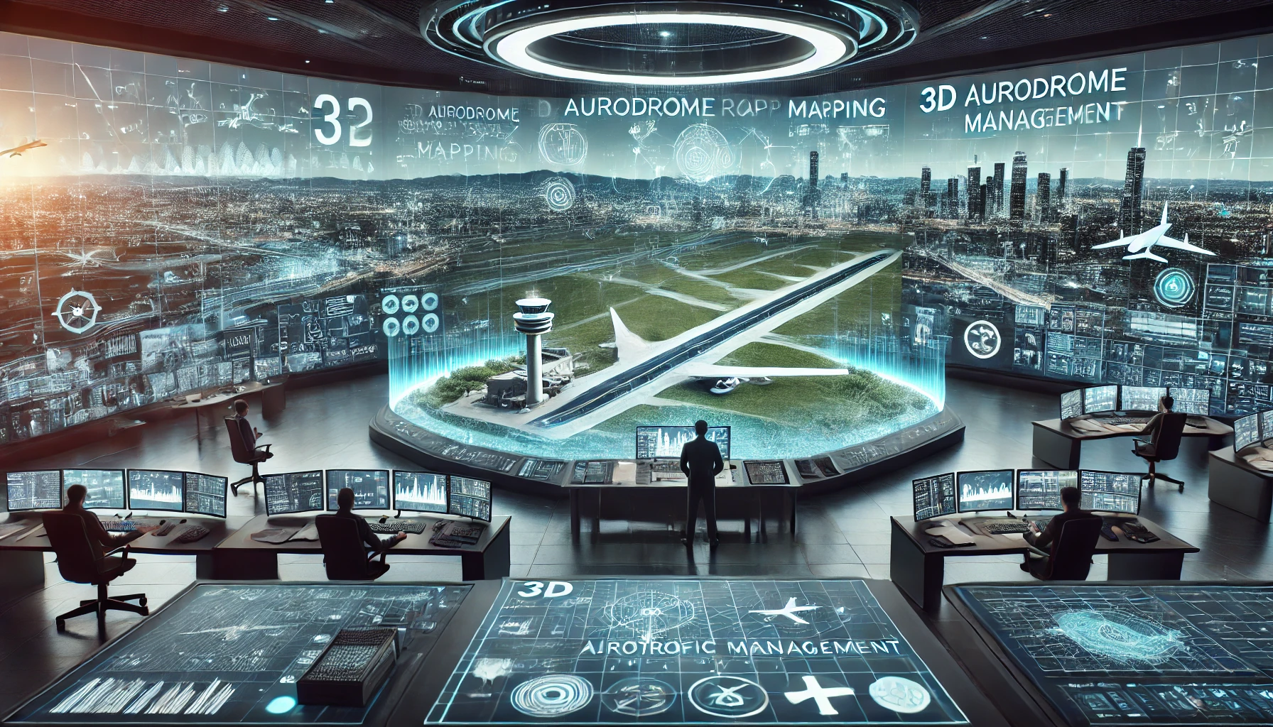
3D Aerodrome Mapping for Next-Generation Air Traffic Management
Imagine a busy international airport, a hub of constant activity where every minute counts. Picture an air traffic controller diligently monitoring screens that not only show planes in the sky but also provide a dynamic 3D view of the airport's layout—runways, terminals, and even the surrounding terrain. This is not the future; this is now, thanks to the advanced technology of 3D aerodrome mapping.
Integrating this technology into air traffic management systems enhances efficiency and safety, guiding decisions that affect thousands of passengers every day. According to recent data, airports using 3D mapping have seen a huge increase in operational efficiency, marking a significant improvement in how air traffic is managed globally.
Understanding 3D Aerodrome Mapping
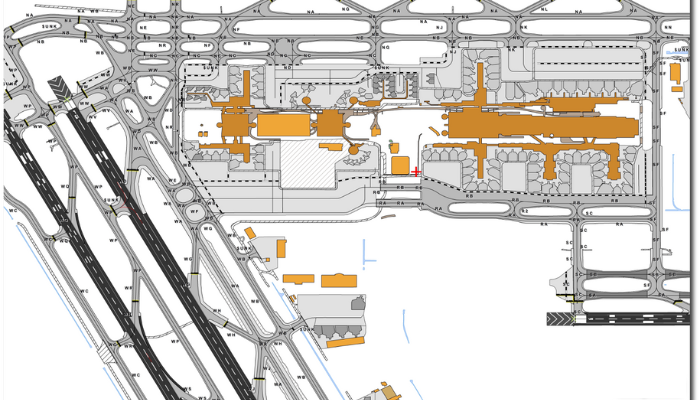
3D Aerodrome mapping transforms traditional flat maps into vibrant, three-dimensional representations of airports. This technology uses data from various sources, including LiDAR and photogrammetry, to create detailed models that are crucial for modern air traffic management.
- Data Collection: Advanced sensors collect data that is more accurate and far-reaching than ever before.
- Model Creation: Specialists compile the data into a 3D model that depicts every aspect of the airport environment.
These models allow controllers and planners to visualize everything in incredible detail, from the height of nearby obstacles to the layout of each taxiway.
Enhancing Pilot Training with Realistic Simulations
Pilots benefit significantly from training in simulators that incorporate 3D airport models. These simulators offer a hyper-realistic experience, allowing pilots to practice landings and take-offs in various weather conditions and at different airports around the world.
By training in this virtual yet realistic environment, pilots gain a deeper understanding of the spatial dynamics of different airports. This preparation is crucial, especially for pilots flying to unfamiliar airports, as it reduces anxiety and increases confidence. Such comprehensive training ensures that pilots are well-prepared, making actual flights smoother and safer.
The Strategic Role of 3D Models in Air Traffic Management
The integration of 3D airport models into aerial navigation management systems is revolutionizing how controllers handle both air and ground traffic. These models provide a comprehensive view that is essential for:
- Route Planning: Controllers can plan the most efficient paths for both arriving and departing aircraft.
- Scheduling: Accurate models help in scheduling by predicting potential bottlenecks and suggesting optimal traffic flows.
By having a detailed 3D visualization, aerial navigation controllers can manage more flights with greater precision, reducing delays and improving overall airport efficiency.
Streamlining Pilot and Ground Crew Coordination
Effective communication and coordination between pilots and ground crews are essential for maintaining airport safety and efficiency. Here's how 3D mapping plays a crucial role in this process:
- Visual Clarity: Provides both pilots and ground crews with a clear, three-dimensional view of the entire aerodrome, including taxiways, runways, and terminals.
- Accurate Positioning: Helps ground crews monitor the precise location of aircraft on the ground, ensuring that all movements are safely coordinated.
- Real-time Updates: Allows for updates on changes in the aerodrome environment, such as temporary obstructions or modified taxi routes, which can be communicated immediately to pilots.
- Enhanced Training: Offers a dynamic training tool for ground crews and pilots, helping them understand complex procedures and layouts more quickly and thoroughly.
- Emergency Response: In emergency situations, ensures that pilots and ground crews have an accurate understanding of the airport layout, aiding swift and coordinated response efforts.
Enhancing Airport Safety and Efficiency
The use of 3D airport models goes beyond just managing aerial navigation; it significantly enhances operational safety and efficiency:
|
Feature |
Benefit |
|
Real-Time Monitoring |
Enables air traffic controllers to track aircraft movements instantly. |
|
Obstacle Detection |
Identifies potential hazards, improving runway and taxiway safety. |
|
Optimized Ground Traffic |
Reduces congestion by managing aircraft taxiing more effectively. |
|
Emergency Route Planning |
Helps first responders navigate quickly during medical or security incidents. |
|
Better Pilot Training |
Provides realistic simulations for pilots to practice various airport scenarios. |
Case Studies:
- Heathrow Airport: Implemented 3D mapping to manage one of the world's busiest airspaces more effectively.
- Singapore Changi Airport: Uses 3D models to streamline operations and enhance safety during both normal and emergency situations.
These examples highlight the practical benefits of 3D models in managing complex airport environments.
Optimizing Emergency Response with Accurate Airport Models
In emergency situations, every second counts. Having a 3D model of the airport layout drastically improves the response times of emergency services. Whether it's a medical emergency or a fire outbreak, responders can quickly find the best routes to reach the affected area without unnecessary delays.
Additionally, these models can be used in emergency drills, allowing teams to rehearse their actions in a virtual environment that mirrors real-world conditions. This preparation is invaluable, as it ensures that all personnel are familiar with the airport layout and can navigate efficiently during actual emergencies.
Future Directions in 3D Aerodrome Mapping
Looking forward, the technology behind 3D aerodrome mapping is continuously evolving, promising even greater impacts on aerial navigation management:
- Higher Resolution Maps: Future enhancements are expected to offer even more detailed and accurate maps.
- Real-Time Updates: Innovations may soon allow these models to update in real time, providing the most current information possible.
These advancements will further refine the capabilities of aerial navigation control, making air travel safer and more efficient.
Facilitating Airport Expansion and Planning
As airports look to expand and accommodate more traffic, 3D mapping serves as a critical tool in the planning process. Engineers and architects use these detailed models to simulate new constructions and their impact on current operations.
This capability allows for better planning of additional terminals, runways, and other facilities, ensuring that new structures integrate seamlessly with existing ones. Moreover, these simulations help in anticipating potential operational challenges before they become problematic, allowing for adjustments in the design phase that save time and money
Final Thoughts
The implementation of 3D aerodrome mapping is not just an improvement but a transformation in aerial navigation management. This technology provides a clearer picture of the aerodrome environment, leading to better decision-making and more efficient, safer handling of flights.
As the aviation industry continues to evolve, solutions like SATPALDA’s Aerodrome Mapping Database (AMDB) provide a cost-effective way to support airport planning, security, and navigation. With accurate terrain and obstacle data, airports can enhance safety and streamline operations. Investing in advanced mapping technology today means a smoother, more reliable air travel experience for the future.
For more details on how 3D mapping supports global aviation, visit amdb.biz.
FAQs
1. What does 3D aerodrome mapping involve?
It involves creating detailed three-dimensional models of airports to improve aerial navigation management and safety.
2. How do 3D models improve air traffic management?
They provide a comprehensive view that helps in efficient route planning, scheduling, and safety management.
3. Can 3D mapping be used in any airport?
Yes, 3D mapping technology can be adapted for any airport, regardless of size or traffic volume.
4. What future developments are expected in 3D mapping technology?
Expect higher resolution maps and the capability for real-time updates to enhance accuracy and responsiveness in air traffic control.
5. What advantages do 3D maps offer to air traffic controllers?
3D maps provide a comprehensive visual layout of airport terrains and airspaces, helping controllers manage flight paths more accurately and safely.