Future of Airport Mapping
Imagine landing at one of the busiest airports in the world. You step off the plane, only to realize you have just 20 minutes to catch your connecting flight. You check a map, but the layout is confusing. Now, imagine an airport where digital maps update in real time, guiding passengers seamlessly from security checkpoints to their gates. This is where the airport map is heading—toward a smarter, more efficient future.
According to recent reports, global investments in airport mapping and digital infrastructure have grown in the past five years. From airports in India map upgrades to AI-driven mapping technologies, the future of air travel is being reshaped by advanced navigation tools. These innovations promise better efficiency, improved security, and an enhanced passenger experience.
How Smart Mapping is Changing Airport Navigation
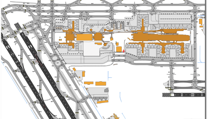
In modern aviation, airport mapping is no longer just about static blueprints. Airports worldwide, including airports in India map systems, are evolving toward dynamic digital models.
- Real-time updates: Airports use GIS-based systems to track ongoing changes in terminal layouts, helping travelers find their way with live updates.
- Interactive 3D maps: Digital models provide passengers with a complete view of terminals, including food courts, lounges, and baggage claim areas.
- AI-driven navigation: AI assists in optimizing walking routes and directing passengers based on real-time congestion data.
With these upgrades, airports worldwide are becoming more intuitive and user-friendly.
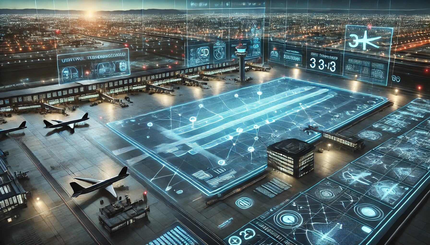
Digital Twins: The Future of Airport Mapping
The rise of digital twin technology is transforming airport maps. These virtual replicas of real-world airports allow operators to monitor every aspect of airport operations in real-time.
|
Feature |
Benefit |
|
Real-time modeling |
Airports can simulate operations and prevent congestion before it happens. |
|
Predictive maintenance |
Sensors detect issues in runways, reducing unexpected delays. |
|
Passenger flow analysis |
AI analyzes movement to reduce bottlenecks in security lines. |
|
Disaster management |
Virtual simulations prepare for emergency scenarios, improving response times. |
|
Energy efficiency tracking |
Smart mapping reduces energy waste by optimizing lighting and heating. |
Major hubs like Heathrow and Changi Airport already use digital twin technology to optimize operations, making airports smarter than ever before.
Enhancing the Passenger Experience with Smart Maps
Today's travelers expect convenience. Airport map is stepping up by providing real-time, interactive maps that improve passenger experiences.
These digital maps help:
- Reduce wait times: Passengers get live updates on check-in counters, baggage claim, and immigration lines.
- Improve accessibility: Smart maps highlight wheelchair-accessible routes and assist visually impaired travelers.
- Enhance shopping experiences: Interactive maps show duty-free stores, restaurant wait times, and special offers.
- Provide multi-language support: Airports cater to global travelers with maps in multiple languages.
- Assist in emergencies: Real-time navigation guides people to exits during fire drills or emergencies.
- Offer indoor GPS: Augmented Reality (AR) overlays provide step-by-step walking directions inside terminals.
Airports like Dubai International and Singapore Changi have already implemented these systems, drastically improving the passenger experience.
Transforming Baggage Handling with Smart Mapping
Losing baggage at an airport is a traveler’s worst nightmare. With thousands of bags moving through terminals every hour, traditional systems often struggle to track and manage them efficiently. However, with advanced airport mapping, baggage handling is getting smarter.
Airports are now using digital maps combined with AI and real-time tracking systems to monitor baggage from check-in to final delivery. Smart mapping ensures that every piece of luggage follows the most efficient route to its destination, reducing the chances of delays or misplacements. If a bag is mistakenly sent to the wrong terminal, the system can immediately detect the error and redirect it.
In addition, real-time baggage tracking is now available for passengers through airport apps. This allows travelers to see exactly where their luggage is at every step of the journey, giving them peace of mind. Some airports have even introduced automated baggage delivery robots that use indoor mapping to transport luggage directly to passengers.
By integrating airport mapping into baggage systems, airports are reducing lost luggage complaints, improving passenger satisfaction, and streamlining operations. With further advancements in AI and IoT, the future of baggage handling is set to become even more efficient and hassle-free.
How IoT and GIS Are Shaping Airport Mapping
Airport map is becoming even smarter with the integration of IoT (Internet of Things) and GIS (Geographic Information Systems). These technologies enable real-time data collection, making airports more efficient.
IoT sensors placed around the airport track everything from runway conditions to passenger movement patterns. Combined with GIS, airports can now:
- Optimize runway management by predicting maintenance needs.
- Enhance security monitoring by tracking unauthorized movements in restricted zones.
- Improve flight scheduling by mapping aircraft movement on the ground.
- Boost efficiency in baggage handling by preventing bottlenecks.
With airports in India map systems embracing GIS-based solutions, smarter navigation and smoother operations are just around the corner.
The Next Big Trends in Airport Mapping
The future of airport mapping is not just about digital maps—it’s about innovation. The next wave of technology promises even greater accuracy and efficiency.
- AI-powered predictive mapping: AI will anticipate flight delays and suggest alternative routes inside airports.
- Autonomous drones for mapping: Drones will create ultra-high-resolution airport maps in real time.
- Blockchain for secure airport data: Mapping systems will store encrypted data to prevent cyber threats.
- Holographic terminal guides: AR-powered holograms will replace traditional signboards, guiding passengers with 3D visuals.
- Voice-enabled airport maps: Smart voice assistants will provide real-time updates on boarding gates and security checks.
With these advancements, navigating airports will become as easy as using Google Maps.
Conclusion
The future of airport map is bright, and we’re only at the beginning of this transformation. With technologies like GIS survey, IoT, and AI-driven mapping, airports are set to become smarter, more efficient, and more passenger-friendly. But the real question remains—how soon will all airports adopt these innovations?
Solutions like AMDB by SATPALDA are making this technology more accessible and cost-effective for global aviation.
By providing highly accurate aerodrome maps, elevation data, and obstacle detection, AMDB supports airport pre-planning, layout optimization, security mapping, and aviation safety operations. As airports continue to grow and modernize, integrating such advanced mapping solutions will be key to ensuring seamless operations and future-ready infrastructure.
To learn more about how AMDB can support your airport’s needs, visit amdb.biz.
FAQs
1. What is airport mapping, and why is it important?
Airport mapping provides digital navigation for passengers, pilots, and airport authorities, improving efficiency and security.
2. How do smart maps help travelers inside airports?
They offer real-time directions, estimated wait times, and accessibility support for smoother navigation.
3. What technologies are shaping the future of airport mapping?
AI, IoT, GIS, and AR are driving advancements, making airport maps smarter and more interactive.
4. Are airports in India adopting digital mapping systems?
Yes, major airports in India are integrating GIS-based mapping to improve operations and passenger experiences.
5. How does airport mapping improve baggage handling?
Airport mapping helps track luggage in real-time, reducing lost baggage incidents and ensuring faster, more efficient delivery to passengers.