Understanding Electronic Terrain & Obstacle Data: How It’s Transforming Aviation
Captain Lee was preparing to land his commercial aircraft on a stormy evening. Mountains surrounded the airport, and visibility was poor. Suddenly, an alert popped up—there was an obstacle dangerously close to his flight path. Thanks to real-time eTOD, air traffic control has already calculated a safer approach. The plane diverted just in time, avoiding a collision.
This scenario isn't rare. According to the International Civil Aviation Organization (ICAO), poor terrain awareness contributes to the majority of aviation accidents worldwide. That’s why Aviation Obstruction detection and terrain mapping have become critical in modern air navigation.
With electronic terrain and obstacle data, pilots and air traffic controllers now have precise, up-to-date data to ensure safe flight paths. But how does this system work, and why is it so essential for aviation today?
How eTOD Helps Pilots Avoid Obstacles
eTOD is a digital database that provides accurate details about Aviation obstructions, such as buildings, antenna towers, and natural landforms. This data is essential for flight planning, landing approaches, and emergency reroutes.
In high-risk areas, like mountain valleys or urban airports, electronic terrain and obstruction data are the difference between a routine landing and a life-threatening situation. Pilots and air traffic controllers rely on this data to adjust flight paths, ensuring safe altitudes are maintained at all times.
Imagine a scenario where a new skyscraper is built near an airport. If this information isn’t updated in navigation systems, a pilot might not be aware of the new Aviation Obstruction until it’s too late. Electronic terrain and obstacle data eliminates this risk by continuously updating terrain and structure data, reducing mid-air surprises.
How Aviation Obstruction and Terrain Data is Collected
The accuracy of electronic terrain and obstacle data relies on cutting-edge technology to capture and update Aviation Obstruction information. Several methods are used to ensure precise mapping:
- LiDAR Scanning: Uses laser technology to scan the terrain and create high-resolution digital models.
- Aerial Surveys: Captures real-time images of terrain and structures from aircraft.
- Satellite Imaging: Provides large-scale views of geographic features.
- Ground-Based Radar: Detects hidden Aviation Obstruction s in low-visibility conditions.
- Drones: Used for detailed analysis of areas that are hard to access.
This combination of technologies ensures that every aviation obstruction —whether a natural mountain ridge or a newly constructed tower—is detected and recorded.
Key Differences Between Traditional and Electronic Obstacle Mapping
|
Feature |
Traditional Mapping |
Electronic Terrain & Obstacle Data (eTOD) |
|
Update Frequency |
Manually updated, often delayed |
Real-time or near-real-time updates |
|
Accuracy |
Limited resolution |
High precision, up to centimeter-level detail |
|
Data Integration |
Paper-based, harder to share |
Digital integrates with cockpit systems |
|
Accessibility |
Localized, not available everywhere |
Global coverage, accessible to all airports |
|
Usage in Automation |
Not compatible with AI or real-time navigation |
Fully integrates with AI-driven navigation |
With electronic terrain and obstacle data, pilots and air traffic control get instant, accurate information, making air travel safer and more predictable.
Real-Life Applications of eTOD in Air Traffic Management
The importance of electronic terrain and obstacle data goes beyond avoiding a mid-air Aviation Obstruction . It plays a crucial role in optimizing air traffic operations.
- Approach Path Optimization: Helps pilots follow the safest and most efficient descent path.
- Emergency Landings: Provides accurate terrain data for safe emergency landings in unfamiliar locations.
- Avoiding No-Fly Zones: Ensures aircraft do not enter restricted or dangerous areas.
- Reducing Pilot Workload: Automates terrain analysis, reducing manual monitoring for pilots.
- Drone Flight Safety: Helps in regulating drone activity near airport zones to avoid interference with flights.
- Weather Adaptation: Adjusts flight paths based on terrain and Aviation Obstruction risks in changing weather conditions.
Airports like Singapore Changi and London Heathrow already use electronic terrain and obstacle data for smoother air traffic management, making every flight safer.
Enhancing Flight Safety with Digital Terrain Data
Accurate digital terrain data is transforming the way pilots navigate challenging landscapes. Traditional maps often lacked real-time updates, making it difficult to detect newly built structures or sudden environmental changes. With modern electronic terrain mapping, aircraft receive up-to-the-minute information about elevation, buildings, and other aerial obstructions.
This technology plays a crucial role in aviation obstruction detection. Pilots can adjust altitude based on real-time data, ensuring safer flight paths, especially in low-visibility conditions. Advanced mapping systems also assist air traffic controllers in guiding aircraft away from potential hazards. With the integration of AI, these systems now predict flight risks before they become threats.
Airports worldwide are adopting geospatial survey solutions to improve navigation and reduce delays. Whether flying over mountainous regions or urban skylines, having reliable aviation terrain database access enhances situational awareness, making modern air travel safer and more efficient than ever before.
Future Innovations in Terrain & Obstacle Data Mapping
The next decade will bring even smarter Aviation Obstruction detection systems driven by artificial intelligence and automation.
- AI-Powered Data Processing: AI can instantly analyze and update terrain data, minimizing human errors.
- Real-Time 3D Terrain Modeling: High-resolution 3D maps of terrain and structures will improve pilot visibility.
- Automated aviation obstruction Detection: AI will scan new construction sites and instantly update aviation databases.
- Augmented Reality for Pilots: Flight decks will display AR-based aviation obstruction alerts for better situational awareness.
- 5G-Powered Data Sharing: Faster and more secure aviation obstruction updates will be shared instantly with global aviation systems.
These innovations will ensure that every aviation obstruction is detected and mapped before it becomes a risk.
Final Thoughts
As aviation continues to evolve, accurate aviation obstruction data is becoming more important than ever. Whether it’s guiding a plane through rough terrain or ensuring a safe landing near skyscrapers, electronic terrain, and obstacle data is a critical tool for modern aviation.
Electronic terrain and obstacle data (eTOD) is transforming aviation by making flights safer and more efficient. This technology not only prevents collisions but also enhances emergency planning, air traffic management, and airport development.
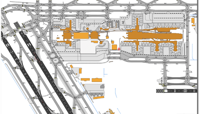
The AMDB from SATPALDA take aviation safety a step further by providing highly accurate maps of airport layouts, terrain, and obstacles. This data is essential for airport planning, security, and navigation, ensuring smoother and safer operations worldwide. As technology advances, innovations like AI-powered mapping and 3D terrain models will continue to improve flight safety.
To learn more about how AMDB supports global aviation, visit amdb.biz.
FAQs
1. What is an obstacle in aviation?
An aviation obstruction in aviation is any structure, natural or man-made, that poses a risk to flight safety, such as buildings, mountains, or antenna towers.
2. How does eTOD improve flight safety?
Electronic terrain and obstacle data provide real-time data on terrain and aviation obstructions, helping pilots and air traffic controllers adjust flight paths to avoid risks.
3. Can pilots access electronic terrain and obstacle data data in real time?
Yes, modern cockpit systems integrate electronic terrain and obstacle data, providing pilots with updated terrain and aviation obstruction alerts during flight.
4. What technology is used to collect eTOD data?
LiDAR, satellite imaging, aerial surveys, and AI-powered sensors are used to detect and update obstacle data.
5. How often is obstacle data updated?
With modern automation, many aviation systems update obstacle data daily or in real time, ensuring the most accurate flight planning.